


Île-de-France Mobilités
Île-de-France Mobilités
Getting around the Paris region is rarely a simple matter of knowing one train line or one bus number. A journey can involve a metro connection, a suburban rail service, a bus stop that is easy to miss, and a last-minute change caused by traffic. Île-de-France Mobilités is built for that complete regional problem rather than for walking directions alone. I found it most useful when I needed to combine ticket decisions, route planning, and current travel information in one place.
This is a free Maps & Navigation app from Île-de-France Mobilités, aimed at everyday travel across Île-de-France. It has been available since early 2012, carries an Everyone age rating, and has become a widely used choice, with more than five million installs and an average score of 4.6 from roughly one hundred five thousand ratings. Those figures suggest a mature public-transport tool, but they do not remove the need to understand how it behaves when your connection is weak, your route changes, or your journey does not fit the usual commuter pattern.
How the app feels when the network is doing the work
The central experience depends on current information. When I searched for a journey with a reliable connection, the app was at its best: I could enter a departure and destination, compare possible itineraries, and use the traffic information to judge whether the suggested route still made sense. That combination matters because a route planner that only gives a timetable can leave you unprepared for a disruption. Here, the value is not just the path between two points, but the chance to check the wider condition of the trip before committing to it.
This network dependence is also the first thing to understand before relying on the app during a rushed transfer. A route search is more useful when the app can obtain current transport information, while ticket-related actions also require a functioning connection at the moment you use them. I would not treat it as a replacement for basic preparation. If I know I will be entering a station with uncertain reception, I check the route beforehand and keep the important station names or line changes in mind.
That habit is especially helpful for visitors. Someone unfamiliar with the region may focus on the final destination and overlook the difference between a direct ride and a route with several changes. The app can expose those alternatives, but a live search is only helpful if it loads when needed. My practical approach is to search before leaving, look at the complete sequence rather than only the first leg, and then check traffic information again before starting the most important part of the journey.
Latest News

Uber Eats Under Pressure: What Happens When Delivery Goes Wrong

How QR & Barcode Scanner Adapts to Android and iOS Innovations

Why Waze Navigation & Live Traffic Is Your Essential Travel Companion

CapCut Mastery: Unleash Hidden Features for Pro-Level Editing

How OS Updates Enhance Roblox Adventures

Teacher Simulator: Exam Time Turns Quick Classroom Judgments into a Repetitive Loop
The traffic view has a different role from the itinerary planner. I use the planner to decide how to travel and the traffic information to decide whether that plan deserves confidence. A route that looks perfect on paper may become less attractive if the app reports a problem affecting one of its services. Conversely, a slightly longer option may be preferable when it avoids a troubled section. The strongest feature is the connection between planning and changing your mind, not simply the existence of a map.
Planning a journey without overtrusting the first result
One useful workflow is to search the trip once for the exact time you expect to leave, then inspect alternatives instead of accepting the first suggestion automatically. I pay attention to the number of changes, the amount of walking between parts of the journey, and whether the route appears vulnerable to one disruption. A route with fewer transfers is not always better if it depends on a service that is currently affected. The app gives me the starting point for that judgement, while I still make the final choice.
This is where the app differs from a general-purpose map. Google Maps or Apple Maps may be more convenient when the journey combines driving, walking, cycling, and public transport across many regions. They are also familiar to people who want businesses, street-level directions, and broader location information in the same search. Île-de-France Mobilités feels more focused: its usefulness comes from being centered on the region’s transport network, tickets, itineraries, and traffic conditions.
Gallery
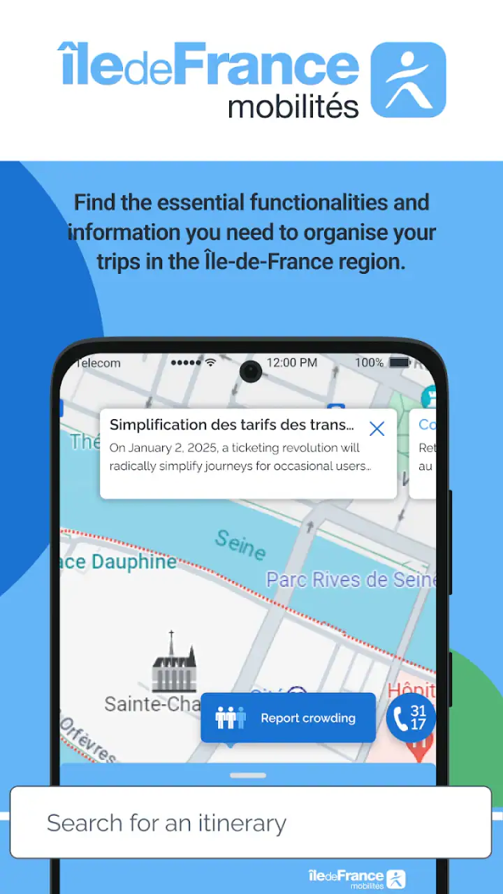
That focus is an advantage for a regular user of Paris-area public transport. I do not have to filter a broad map interface to reach the transport information I actually need. It is less compelling if your trip begins far outside the region, depends mainly on a rental car, or requires a detailed walking guide after leaving the station. In those cases, I would use this app for the regional transport portion and keep another navigation tool available for the rest.
Buying tickets in the middle of a real journey
The ticket function changes the app from a passive planner into something I can use immediately before boarding. That is convenient when I realize I have not prepared the right fare or when a spontaneous trip takes me somewhere I had not planned to visit. Keeping ticket access beside itinerary search reduces the need to jump between separate transport tools, which is particularly useful for visitors who are still learning how travel in the region is organized.
There is a practical trade-off, though. A ticket purchase is not something I want to begin while standing in a crowded entrance with a poor connection and no time to troubleshoot. I prefer to handle it before reaching the barrier or platform, leaving enough time for the transaction to complete and for me to understand what I have bought. The app makes the process more accessible, but it does not make connectivity or last-second decisions disappear.
I also think the ticket workflow is most valuable when paired with route planning rather than used in isolation. First I check the journey and its zones or transport needs as presented in the app, then I choose the appropriate ticket option. That order reduces the chance of buying something before I understand the trip. Even experienced riders can benefit from separating “where am I going?” from “what do I need to travel there?”
Using it on the move, when attention and signal are limited
Mobile use is where the design has to prove itself. At home, I can calmly compare routes. On a pavement, platform, or bus stop, I may have one hand occupied and only a few seconds to confirm the next step. I found the app more useful when I treated it as a sequence checker: verify the next service, identify the interchange, and then stop looking at the screen while moving through the station.
That approach avoids a common mistake with navigation apps: staring at the phone instead of reading the physical signs. Île-de-France Mobilités can tell me the planned itinerary, but station layouts and platforms still require attention. If a connection involves a long walk or a complicated interchange, I use the app to prepare mentally, then follow local signage. This is safer and often faster than repeatedly reopening the route while walking.
A realistic example would be leaving work later than expected for an appointment on the other side of the region. I would search the destination, compare the suggested routes, and check the traffic information before leaving the office. If the preferred line showed a problem, I would choose a route with an extra change but fewer signs of disruption. At the station, I would confirm the first departure, save the key sequence in my memory, and only consult the app again at the interchange. That workflow uses the app’s strengths without making the phone a single point of failure.
For visitors, the most valuable mobile habit is recording the destination and the major interchange mentally before entering an underground section. Names can be difficult to pronounce or remember, and a weak connection may make a fresh search slow. I would note the line changes and final station rather than relying on a screenshot as if it guaranteed live updates. A stored image can show what the route looked like earlier, but it cannot tell me whether the service has changed since then.
What happens when a route breaks
No transport planner can prevent a cancelled service, a missed connection, or a phone that loses reception. The question is how well the app supports recovery. Its traffic information is important here because it can alert me that the original plan is no longer the sensible one. Instead of treating the first itinerary as fixed, I use the app as a way to rebuild the journey from my current position or from the next practical station.
The recovery process works best when I do not wait until the exact moment of failure. If I see a warning before leaving, I can compare alternatives while I still have time and a stable connection. If the problem appears after I am already traveling, I first move to a safe place away from the platform edge or station flow, then search again. This small change in behaviour makes the app more useful: I am asking it a clear new question instead of repeatedly refreshing an outdated plan.
There is friction when the connection fails at precisely the wrong moment. A live traffic update cannot be assumed to arrive without network access, and a ticket action is not something I would postpone until I am underground. This is the main limitation of a connected regional transport app. It can be much more current than a static timetable, but current information is tied to the availability of the service that delivers it.
For that reason, I would not recommend depending on it alone for a time-critical journey with no margin. Before leaving, I check the route, identify a fallback interchange, and make sure my phone has enough battery for the trip. Those are not glamorous features, but they are the difference between using the app intelligently and expecting it to solve every travel problem automatically.
Keeping mobile data use sensible
People often ask whether a transport app will consume a lot of mobile data. The honest answer is that usage depends on how often you request itineraries, refresh traffic information, and use map content. I avoid repeatedly refreshing the same screen when I am stationary. Instead, I check for changes at meaningful points: before departure, before a major transfer, and after an unexpected delay.
This pattern is useful for more than saving data. Frequent refreshes can create confusion when small changes make the route list shift while I am already following a plan. A deliberate check gives me a clearer comparison between the original journey and the revised one. If I am on a limited connection, I also prefer text-based route details over constantly browsing map views, because the practical question is usually which line or stop comes next.
Battery deserves the same attention. Screen brightness, location use, repeated searches, and a long day of travel can all reduce the phone’s reserve. I carry a small power bank for unfamiliar trips, but I also reduce dependence on the app by learning the next interchange before boarding. This is one of the less obvious advantages of using the planner carefully: it can help me prepare a route, not just guide every metre of it.
Privacy-minded users may also prefer a restrained workflow. I use the app when I need a transport decision and avoid leaving it open continuously in the background. That keeps the phone focused on the journey rather than turning navigation into a constant activity. Since the app is free, there is no purchase barrier to trying it, but free access does not mean the phone’s connection, battery, or attention are unlimited resources.
Who should use it, and who may prefer another tool
I would recommend Île-de-France Mobilités to residents, commuters, students, and visitors whose trips are primarily within the Paris region and involve public transport. It is particularly suitable for people who want one regional place to search itineraries, handle tickets, and monitor traffic conditions. The age rating is Everyone, so it is presented as an app suitable for a broad audience, although younger users still benefit from an adult helping them understand tickets and transfers on unfamiliar routes.
It is also a good fit for occasional riders who do not want to memorize the network. The app can turn a complicated trip into a set of manageable decisions: where to start, which service to take, where to change, and whether current conditions justify an alternative. I would still advise first-time users to read the entire itinerary before walking toward a platform. The most confusing part of a route is often not the first train but the transfer later on.
On the other hand, I would skip it as my only navigation app if my needs are mostly outside Île-de-France, if I need extensive car navigation, or if I want business discovery and broad walking guidance. A general map service is better for a mixed trip involving hotels, restaurants, road directions, and several cities. This app is more specialized, and that specialization is exactly why it can feel clearer for regional transit while feeling narrower elsewhere.
Compared with relying on station posters or printed information, it offers a more flexible way to react to changing conditions and to bring ticket actions into the same mobile experience. Compared with a general map, it offers a more transport-centered workflow for the region. Neither comparison makes it universally superior. The best choice depends on whether your main problem is understanding the Île-de-France network or navigating the entire world around it.
My practical routine for dependable use
Before an important journey, I search the route while connected, compare at least one alternative, and check the traffic information. I then make a note of the main interchange and final stop. If I need a ticket, I handle that before entering the busiest part of the station. During the trip, I check again after a significant delay or before a complex transfer, rather than refreshing continuously.
If the app does not load, I use the information I already reviewed and look for official signs or staff assistance at the station. Once the connection returns, I search from my current location instead of trying to force the original route. This recovery method is more reliable than assuming the first itinerary remains valid after a disruption.
That routine also answers the question of whether the app is suitable for tourists. Yes, provided they use it as a planning aid and allow time for ticket decisions and transfers. It is less suitable for someone who expects a fully independent guide through every station without reading signs or adapting to local conditions. The regional focus helps, but public transport still requires observation.
My connectivity verdict
After using it as a regional travel companion, I see Île-de-France Mobilités as a practical, focused app whose best moments happen when it can connect planning, ticket access, and current traffic information. Its free price makes it easy to try, and its strong user response reflects how useful that combination can be for everyday travel. The developer, Île-de-France Mobilités, has kept the purpose clear: help people make transport decisions across the region rather than overwhelm them with unrelated navigation tools.
My main reservation is not about the concept but about timing. Connectivity matters most when the journey is already under pressure, so I would never wait until the platform to perform every important action. Search early, understand the route, prepare a fallback, and use live updates at sensible points. With that approach, the app becomes a dependable aid instead of a fragile source of instructions.
My final recommendation is simple: use it if your travel life is tied to Île-de-France public transport and you want current, region-specific help in one place. Keep another map available for broader navigation, and keep a little personal knowledge ready for moments when the signal disappears. For the right user, that balance makes this a genuinely useful everyday app rather than just another route search box.
FAQs for Île-de-France Mobilités
What is Île-de-France Mobilités and what does it offer?
Île-de-France Mobilités is a comprehensive travel app designed to help users navigate the public transportation system in the Île-de-France region. It provides real-time information on buses, trains, trams, and metros. The app offers route planning, ticket purchasing, and service alerts, making it essential for both residents and visitors.
Is Île-de-France Mobilités available for both Android and iOS devices?
Yes, Île-de-France Mobilités is available for download on both Android and iOS platforms. Users can find it on the Google Play Store and the Apple App Store, ensuring that it is accessible to a wide range of smartphone users. The app is designed to function seamlessly across different devices.
Does the app provide real-time updates on public transportation?
Absolutely, Île-de-France Mobilités offers real-time updates on the status of public transportation services. This includes live tracking of buses, trains, trams, and metros, as well as notifications about delays or service changes. This feature helps users make informed travel decisions and avoid unexpected disruptions.
Can I purchase tickets through the Île-de-France Mobilités app?
Yes, the app allows users to purchase tickets directly from their smartphones. It offers various ticket options, including single journeys and passes, which can be used across different modes of transport. This feature provides a convenient and hassle-free way for users to manage their travel needs.
What languages does the Île-de-France Mobilités app support?
The app primarily supports French, reflecting its primary user base. However, it also offers English language options, making it easier for international travelers to navigate the public transport system in Île-de-France. This multilingual support enhances accessibility for a diverse range of users.
Pros
- User-friendly interface for easy navigation.
- Real-time updates on arrivals and delays.
- Comprehensive route planning options.
- Supports multiple transportation modes.
- Customizable alerts and notifications.
Cons
- Limited offline functionality.
- Occasional GPS inaccuracies.
- Requires constant internet connection.
- Interface can be slow during peak times.
- Limited language options available.


